Tuesday, 17 March 2015

The Historic Environment Action Plan, and the landscape of Woodbury Parish

The Historic Environment Action Plan (HEAP)

Back in 2013, the East Devon Area of Outstanding Natural Beauty (funded by English Heritage) piloted this innovative project in two parishes - Woodbury and Branscombe.  The Project aimed to identify and explore the most important heritage features in each parish's landscape, to consider what issues are affecting them, and to create a strategic and community-based Historic Environment Action Plan (HEAP).  A HEAP is intended to be a positive statement of what each parish values and why, what future steps could be taken to explore its heritage further, and how these might be achieved.

In Woodbury, the Project was co-ordinated by the Local History Society, with the participation of other interested individuals. Building on 20 years of research activity, a group of Society members responded by asking new, deeper questions about some (out of many possible) elements of the historic landscape, particularly since the time of the Tithe Map in 1839 - a digitised version of which is available online at the Woodbury village website.

Four historic mapping workshops took place in the parish, of which two were in Woodbury Salterton.   Several key participants of the Project were from Woodbury Salterton: Prof Patrick Dillon and Priscilla Trenchard carried out a Subjective Geographies project in the village, which you may remember from questions they asked at the mapping days, and to the school and the WI.  Sally Elliott made an extensive assessment of old woodland, and Diana Wackerbarth assisted Roger Stokes of the History Society in compiling the final report, pulling together a very wide and idiosyncratic variety of contributions.

That report is now complete, and has been published on the Woodbury village website (click on 'Woodbury HEAP report' in the Contents list on the left-hand side of the page), and the Woodbury Local History website.   Funding is being explored to print hard copies for wider circulation in the parish. 

The reports of both the participating parishes, and also Lympstone, are also available on the East Devon AONB website.   If you ever wondered what Woodbury Salterton looks like from the point of view of a dog or a horse, the Subjective Geographies report is also on that website - and is very informative about perceptions of the village.

You may also be interested to see the excellent and very different way that Branscombe parish has taken the work forward - especially if you came to one of the mapping days and wondered, 'What next?'  See the Branscombe Project's website.


Future of the Project

The Woodbury report is a mine of information, description and illustration.  But in a way both reports just mark the end of a first stage, and questions of significance and future action have still to be explored.  Here are some next steps:
  • Sat 18th April - East Devon AONB Historic Landscape Conference. The results of the HEAP Project will be presented at this conference at the Norman Lockyer Observatory in Sidmouth.  Anyone is welcome to attend if you are interested  http://www.eastdevonaonb.org.uk/uploads/documents/conserve/Culture%20and%20Heritage/flyer.pdf
  • A Woodbury News article will be appear after that meeting, when there is more clarity about the future of the HEAP Project as a whole. 
  • Thursday 3rd Sept in WVH  There will be a joint Woodbury History Society meeting with the Branscombe Project, at which both groups will present their reports - visitors welcome to the meeting.
  • 'Woodbury Then and Now'  The Woodbury Camera Club is undertaking a project to re-photograph a number of historic views of the villages in the parish from Roger Stokes' vast collection.  They will show the first results at the joint meeting on Sept 3rd, and are also working towards putting on an exhibition and publishing a small book. 
Several ideas arose from the process, and those of us in Woodbury Salterton would like to take some of them forward - for instance, a local history walk in the village, and a series of related talks or other events.  If you are inspired by any aspect of the Project, we would love to hear from you.

As a taster of the report, here is the section we wrote as background on the landscape of the parish.  The information was drawn from the Parish Design Statement, the Parish Biodiversity Audit; the local history publications 'Woodbury Parish: 1894-1994'  by Sally and Ramsay Elliot (eds.), and 'Woodbury: a view from the Beacon' by Ursula Brighouse; and from 'Interpreting Landscapes' (2010) Christopher Tilley (Chap 6, 'Sensory experience on the East Devon Pebblebeds).


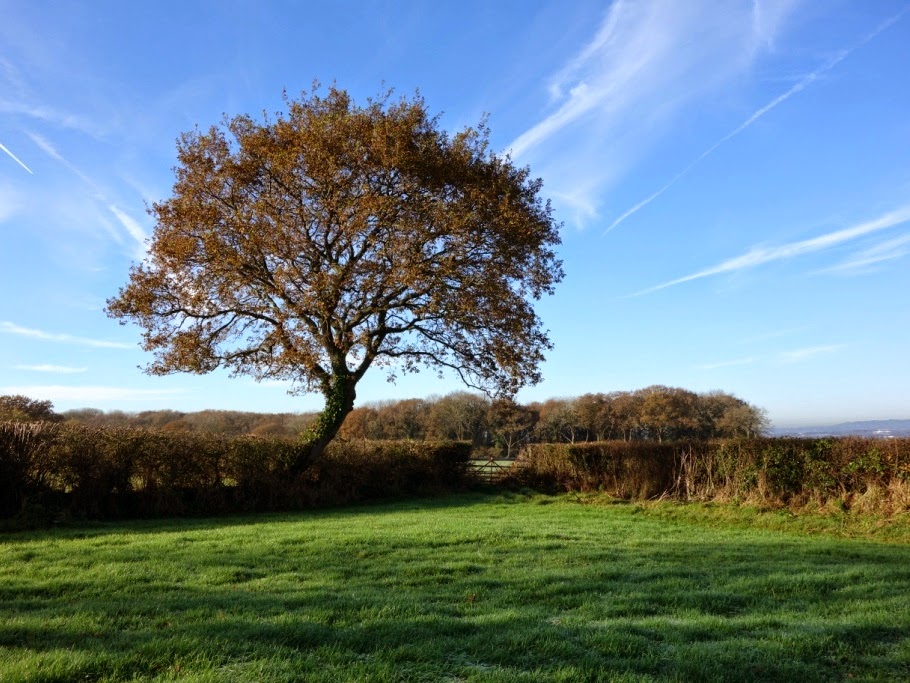
The landscape of Woodbury Parish

Woodbury Parish lies south-east of Exeter, between the city and Exmouth.  It is one of the largest in Devon (with a population in 2001 of 3,337), and occupies 6,531 acres of gently undulating rural land.  It is also perhaps one of the most diverse in the county, in terms of its variety of landscape.

In the west at Exton, the Parish extends into the middle of the Exe Estuary, with its internationally important salt-marshes and mud flats; and in the east, to the hills of the East Devon Pebblebed Heaths, where one of the largest expanses of lowland heath in southern Britain can be found.

Between these lies a broadly agricultural landscape of fields, which are mostly intensively managed pasture or arable land.  Away from the main roads, the network of narrow winding lanes, between Devon hedge-banks, has miles of traditional species-rich hedgerows with mature hedgerow trees.  Combined with these, scattered small woodlands and copses make the landscape appear very wooded.  Nestled within it are the three main villages of Woodbury at the centre of the parish, Woodbury Salterton and Exton, together with the hamlets of Grindle, Gulliford, Nutwell, Venmoor and Woodmanton, and a number of individual farms. 

The variety of scenery, elevation, aspect and ecology in the parish is considered to be a large part of the charm of its heritage.

The parish can be seen as a whole from the highest point of Woodbury Common, about 175m above sea-level on the Pebblebed Heaths.  Its situation can be understood within a far wider landscape adjoining on one side Lyme Bay – which can be seen eastwards towards Dorset along the Jurassic Coast World Heritage Site to Beer Head (and sometimes as far as the Isle of Portland) – and, on the other, the Exe estuary and South Devon coast south-westwards to Berry Head. 

To the west the view extends beyond the Haldon Hills to Dartmoor, to the north beyond the Raddon Hills to Exmoor, to the east to East Hill ridge, to the south-east to Peak Hill and High Peak, and to the south to the estuary of the River Otter at Budleigh Salterton, and the heathlands north of Exmouth.

Much of the parish landscape is underlain by Littleham mudstone, a mixture of mud and silt that creates the fertile, heavy clayey subsoil characteristic of the area, and also greatly influences local drainage.  There are occasional sandy outcrops, such as Windmill Hill (close to the northern boundary of the parish) and the low ridge to the west of Woodbury.  A particular feature of the soils is the multitude of large pebbles contained within them, known locally as ‘pobbles’ or ‘popples’.  These originate from the slopes of the Pebblebed Heaths, and their wide use in vernacular building has created a distinctive local style.  The ridge of the Heaths is the remains of an ancient riverbed that flowed from south to north through a red sandy desert.  Formed entirely of pebbles, it is absolutely unique in the United Kingdom.  [See also the blog post of October 2014 which included an article by Nicky Hewitt of the RSPB about the Commons].  At the base of its steep western scarp slope, a springline drains towards the Exe estuary and the River Clyst.

The parish is rich in areas of particular landscape and habitat significance.  The East Devon Pebblebed Heaths are part of the East Devon Area of Outstanding Natural Beauty.  Their lowland heathland habitat is one of the most important conservation sites in Europe, designated a Site of Special Scientific Interest, a Special Area of Conservation, and a Special Protection Area.  Below the heathland, the belt of farmland includes an area adjacent to the AONB in the southeast of the parish that is designated an Area of Great Landscape Value.  In addition, the Exe estuary is nationally important for its coastal habitat and designated a Site of Special Scientific Interest and a Special Protection Area, and is also a Ramsar site for its international significance as a waterfowl  habitat.

The known human story of the parish begins around 7000BCE with hunters of the Mesolithic period, through the Neolithic woodland clearance from about 4000BCE, and the Bronze Age creation of at least 26 round barrows on the Pebblebed Heaths between about 2000 and 1000BCE.  These are the oldest known monuments in the locality and suggest that it was a significant funerary landscape in that period.  Two of the barrows are important landmarks on the ridge of the Commons.  Also prominent on the highest point of the skyline – and with exceptionally long views in every direction – is the early Iron Age hill-fort of Woodbury Castle. 

The extent of Roman presence here is uncertain, but the landscape of farms and smallholdings, ancient field patterns and banks, sunken lanes and hedgerows is, however, of great antiquity.  Much of the existing settlement pattern was established in Saxon times, when Woodbury acquired its name, and medieval strip fields still exist in some places.

In the modern era, the character of the parish has been much affected by its proximity to Exeter (7 miles) and Exmouth (4 miles), and to national road, rail and air communications.  Alongside the many ancient and historic features, the contemporary landscape includes diversification of agricultural land into more recent new housing, business parks and leisure uses. Currently, many fields around the settlements are under threat of further housing development.


Monday, 16 March 2015

New planting at Parkhayes Plantation

Parkhayes Plantation is the triangle of open woodland alongside a tarmac footpath at the west end of the village, bordering Lower Road and accessible from Parkhayes, too.  It is managed by Woodbury Salterton Residents Association (WSRA) on behalf of the Parish Council, and is being developed for enhanced public enjoyment, greater biodiversity, and as an educational resource. We first reported on it in our blog post of April last year, which included some history of the site, as well as its natural history.

Projects undertaken during 2014 included the erection of a number of bird- and bat-boxes in the trees, and the creation of a 'bug hotel' and a wood pile to create additional habitats.  Some trees were pruned and dead ones removed to increase the light reaching the woodland floor.  A mown path was maintained through the site, and an information board was installed.  WSRA is grateful to the Follies (Woodbury Music Hall) for two grants that were awarded, in 2014 and again this year, to support wildlife projects here.

Bug hotel above, and
wood-pile below.


If you would like to be involved in this on-going scheme, please contact one of us or any member of the WSRA committee. 


Parkhayes habitat management


Parkhayes Plantation in February,
before clearance and new planting on the bank began.

Last autumn, the Residents Association was fortunate to receive funding from the Parish Council for a sub-group of interested individuals to discuss the management of this site with ecologist Ben Wyatt, of Devon Wildlife Consultants.  The group wanted to understand its possibilities and limitations, and to explore the scope for enhancing its biodiversity.  

The Plantation consists mostly of mature broad-leaved trees, bordered by a long grassy bank beside the main path.  One aspect that was discussed was the potential for encouraging more wild-flowers.  Another was the planting of an understorey or shrub layer, which could create a more varied habitat for insects and plants, and foraging and nesting places for birds.

Historically, the site was used for waste of all kinds and, as a consequence, the soil is very nutrient-rich.  Unfortunately, this has created ideal conditions for much of the area to be taken over by cow parsley, perennial rye grass and nettles.  Many wild-flowers actually prefer poorer conditions, and in such fertile soil they struggle to compete with these dominant species.   WSRA would like to encourage a greater variety of wild-flowers here, but creating the right conditions for them to thrive would involve a lot of dedicated work over a long period.  


Native spring bulbs

The group decided to focus initially on planting native spring bulbs, at the end of the Plantation close to Lower Road.  There has already been a good showing of snowdrops - very small, as yet -around the base of a tree there.  They are one one of the first flowers of the year, and - with a slight honey scent - they are very attractive to bees, being their earliest food source.  Snowdrops are possibly not native to Britain, but they have been growing wild - especially in the south and west - for at least 250 years.


Native snowdrops at Parkhayes
Plantation, Galanthus nivalis

Wild daffodils used to occur widely throughout Britain, and common names include Lent Lily and Easter Lily.  They went into a mysterious decline in the mid-nineteenth century, but Devon remained one of the few areas where they continued to flourish - although colonies are very scattered,  perhaps because of changing climate or land management practices.  Locally, they were once much more common than they are now - some of the oral histories collected in the village about twenty years ago (by Sally Elliott and others), make particular mention of places where they grew.   

WSRA is very glad to be able to reintroduce wild daffodils into Parkhayes, and they are now emerging among the established cultivated varieties.  They are notable for being smaller, prettier and more graceful than these.


Native daffodil Narcissus
pseudonarcissus 'lobularis'

[image courtesy of 
http://www.wildflowershop.co.uk/
where the bulbs were sourced]

Native bluebells have also been planted, but the leaves have yet to appear.  Like wild daffodils, these too are less common than they once were.  They often cross-fertilise with the cultivated Spanish blue-bell, which is far more vigorous.  Native bluebells are more delicate in appearance and have a curved stem, unlike the hybrids whose stem is straight.


Native bluebells
Hyacinthoides non-scripta

[image courtesy of 
http://www.wildflowershop.co.uk/]


A shrubby understorey

Several areas of rye grass and nettles have recently been cleared on the bank alongside the path, and are now planted with clumps of native shrubs which will create an understorey to increase biodiversity.  The blocks of planting include hazel, guelder rose, alder buckthorn, wild privet, common dogwood, and dog-rose.  To inhibit the re-growth of the dominant ground cover, the clearings have had a light mulch of bark chippings, which will be added to with grass clippings from neighbouring gardens. 


In addition, thirty hawthorn and blackthorn have been planted on the bank at the rear of the site.


Hazel and buddleia have been planted behind the information-board.


The tree-guards and many of the trees came from the free 'Tree Pack for wildlife' donated to WSRA by the Woodland Trust.  The shrubs were funded by a private donation and sourced locally from Perrie Hale Nursery (near Honiton) that specialises in trees and shrubs for hedgerow, forestry and amenity planting.

These images (most of which are courtesy of the Royal Horticultural Society's online plantfinder) give a foretaste of what is to come.


Hazel
The yellow of the catkins provides the first real
colour of the year in a woodland or hedge, and
they are a crucial early food source
for bees and other insects.

Guelder rose
Its white flowers are similar to lace-cap hydrangeas
and its berries and leaves provide late-summer
and autumn colour.
 

Alder buckthorn
Bright red berries, ripening to black,
and good autumn colour.

Wild privet
Rarely seen in a clipped hedge,
wild privet has flowers like
miniature white  lilac, followed
by glossy black berries. 

Common dogwood
Small white flowers in flat clusters, followed by
black berries.  Good autumn colour,
and young stemsare red in winter.

Dog rose
A scrambling climber with white or pale pink flowers
in summer, followed by ovoid red fruits.

Hawthorn
A small rounded deciduous tree, with flat sprays
of cream flowers, followed by dark red berries.

Blackthorn
A small thorny deciduous tree, with small white flowers
in early spring, followed by ovoid black fruits
known familiarly as sloes.

Buddleia
Often known as butterfly- bush.  Introduced from
China in the late 19th century, this has spread
across most of Britain, and has perhaps been
the saving of butterfly populations, especially in
urban areas.  Long, honey-scented flowers from July
to October are a favourist nectar source for many
butterflies and moths.  [Image courtesy of
http://www.buddlejagarden.co.uk/]


Wednesday, 14 January 2015

Higher and Lower Roads

In this post we explore some historical aspects of the landscape to the west of the Woodbury Salterton.

Crosshills, at the corner of Higher Road and Lower Road.

Taking the right turn out of the village towards Exeter, along Lower Road at the Crosshills corner, it is perhaps difficult to realise that within living memory the preferred route was instead straight ahead up Higher Road.  This was possibly because it was less prone to flooding, but Lower Road eventually became more favoured and was tarmacked first.  Higher Road, on the other hand - like other local minor lanes - was still formed of cracked stone up until the early 1960s.  Until the late 1970s, Lower Road was part of a bus route between Exeter and Budleigh.

Navigating the narrow length of Lower Road, it is also easy to miss that historically this is one of the most interesting areas of our surrounding landscape ... 

On the north side of Lower Road, as far as Heathfield Cross (the junction with Greendale Lane), the fields are long and narrow. This pattern is clearly visible on the modern two-and-a-half inch map, and is thought to be a relic of the medieval communal open-field system, still evident in the landscape.  It is very little altered since the time of the Tithe Map of 1839, and is presumed to date back to the agricultural land enclosures of the mid-18th century. 

The field names, too, are interesting, and indicate the nature of this land in the past.  'Heathfield' was an area of poor land or 'waste', open-country for common use, until it was enclosed: the nearby field-name 'Lousy Five Acres' perhaps suggests what quality of farmland this was!

Also in this area, opposite Bidgoods in Lower Road, is the last remaining old working orchard in the parish, whose produce is still used in commercial cider-making.  

It feels appropriate to be covering this at apple wassailing timeWoodbury Community Orchard has its wassail this Friday evening 16th January at 7pm, to which all are invited.  See p10 of the current issue of Woodbury News for more information. 


~  ~  ~

We have been very involved in compiling the soon-to-be-published Historical Environment Action Plan for Woodbury Parish (in conjunction with the East Devon Area of Outstanding Natural Beauty and English Heritage) - hence the delay in producing this post, and also its focus on landscape history rather than on the natural world.  The photographs were taken in October and November 2014.  

The oral history information came from conversations in October between Sally Elliott and two people with deep connections with the village.  Several generations of the family of George Wilson (formerly of Bidgoods) farmed in the Heathfield area for over 200 years.  Jeff Dagworthy's family has been in the village even longer - since the 16th century - and he still lives at Browns Farm, which the family has occupied since the late 17th century.  We are grateful to both of them for their memories and information.

Finding out old field names is a bit of a labour of love, but not too difficult.  The information comes from the digitised Tithe Map of 1839 which can be accessed by clicking on the contents list on the Woodbury Village website.  On the map the fields are numbered, and their names are listed in number order in the Tithe Apportionment Book, which is also on the website.  

For more general information about landscape history, we draw on renowned Devonian historian W G Hoskins' The Making of the English Landscape, Francis Pryor's more recent book, The Making of the British Landscape, and Victor Bonham-Carter's The English Village.
~  ~  ~

"Ye'll tak' the high road ... "

Taking the quieter 'Higher Road' first, beyond Crosshills it begins as a sunken lane leading up to Downhams, which is still a working farm.

Higher Road, heading west, begins as a sunken lane.
The horizontal stems of out-grown hedge trees
show that this was once a laid hedge on a Devon bank.
More out-grown hedge trees.
Looking back down Higher Road towards the village
from the entrance to Downham's Farm buildings.
Opposite the farm entrance, this hedge has been retained
but with some hedge trees growing to full height at the back.

Above the buildings of Downham's Farm, on both sides of Higher Road many of the old fields have been amalgamated.  Here two on the south side, previously known as 'Little Two Acres' and 'Higher Two Acres', were once village allotments, but are now part of a much larger field.  Within living memory, the village football pitch was on the more level of these - until 1967 when it was moved to the Glebe Field instead.  


This fairly level field on the south side of Higher Road
was once the village allotments and later the football pitch.

From the highest points of this lane there are long views across Exeter and towards the Raddon Hills to the north of the city. Several of the fields on this side include the name 'Bowhay' (pronounced Boohy) which is thought to refer to a person's name.

From fields on the north side of Higher Road there are 
extensive views across Exeter towards the Raddon Hills.
The lane leading to Higher Pilehays Farm,
at the right-angle bend in Higher Road.

At the junction with the lane to Higher Pilehays Farm, the field to the west was known as 'Lousy Five Acres'.  In the past one of the fields here always gave trouble to the Dagworthys who farmed it - causing the cows to produce tainted milk.  In this area some of the fields are smaller and more irregularly-shaped.  

Hard to show in a photograph,
this field on the west of  Higher Road is in fact triangular.
View west to the Haldon Hills
Lane from Higher Pilehays looking north towards Heathfield Park.
'Little Park': triangular field opposite Heathfield Park.

The land around Heathfield Cross was reclaimed and enclosed from former 'waste' in the mid-18th century.  That it continues to be marshy, however, is evident in the presence of needle-rush in several fields here, which would take over the land if un-checked.


Looking towards Heathfield Cross from Heathfield Park.
Heathfield Cross: gorse in the field boundary (above)
and rough ground (below) are here perhaps relics 

of the former 'waste'.


Heathfield Cross and Greendale Lane:
one of very few remaining ponds glimpsed through the hedge.
View north from Heathfield Cross along Greendale Lane (above)
and east along Lower Road (below):
the Scots pines were planted as boundary markers
by an owner of Greendale House in the 19th century.


" ... and I'll tak' the low road ..."

All along the north side of Lower Road is a series of long narrow fields running down the slope towards Grindle Brook.  Since the time of the Tithe Map of 1839, very few hedges have been taken out, so the landscape here is a relatively rare survivor of an agricultural landscape which has been little altered for several hundred years.  

The common-field system  originated in the Anglo-Saxon period (from about the 9th century) and in Medieval times was widely established throughout England.  Individuals farmed several strips scattered throughout large, common, open fields, to ensure a fair distribution of qualities of land.   The size and shape of the strips was determined by the capabilities of heavy, ox-drawn ploughs. Typically, each strip was twenty-two yards wide and two-hundred-and-twenty yards long, which was the distance an ox-team could plough without a rest (a furrow-long, or 'furlong').  This amounted to one acre in all, which was the area of land ploughable by oxen in a single day.

This form of farming started to be abandoned from the 15th century onwards.  Over time, individuals' strips often became amalgamated - usually by agreement.  By the period of the land enclosures - in this case in the mid-18th century - tenure within the common-field here was perhaps already divided into parcels. The shape of the present fields suggests that they were based on the original strips.  In the early 19th century, these fields were owned by a variety of individuals, which perhaps reflects historic tenure, and is possibly also why they have not been consolidated into larger fields to the same extent as elsewhere.

Field names at the time of the Tithe Map are also suggestive - 'Two Acres' and 'Three Acres', adjacent to Heathfield House, for example, perhaps refer to the standard acre of earlier strips.

Some of these field-names include 'Park',  which was usually an indicator of good quality land.  'Pit Field' or 'Small Moor', on the other hand, indicate poorer quality.

Above and below:  three of the long narrow fields
along the north side of Lower Road.


One historical curiosity - which is almost impossible to spot! - is the former entrance to what was once a very narrow lane leading north from Lower Road.  'Chilfie Lane' (as was) ran alongside the property now known as Meadow Rise, accessing fields further down the slope away from the lane.  In 1840, its name was recorded as 'Chelfy' or 'Chilpy', and earlier still, in auction details of 1732, it was written as 'Shelfhay'.  'Hay' is a word for 'field', and thus this name might mean 'Shelf Field' and may refer to its shape or topography - although the meaning is almost as lost as the lane itself, buried within the hedgerow.


Easy to miss!  The 'entrance' to 'Chifie Lane' in the hedge
on the north side of Lower Road
next to Meadow Rise.

Further on, opposite Bidgoods, are two old orchards, known jointly as 'Perchy Orchard'.  It is now the last working orchard in the parish and the crop is used commercially by Green Valley Cider at Darts Farm, to create Bidgood Orchard Cyder.  The crop can be very variable, and trees typically rest alternate years.  Last year's crop was only 3 tons compared with 15 tons the year before. There are several old varieties of apple here - Thomas Putt (a locally developed variety), Michelin, Coate Jersey and Debonet.


Perchy orchard on the south side of Lower Lane 
opposite Bidgoods.


Cider-production used to be a very significant part of the local economy, as cider was a crucial alternative to water for drinking, and cider vinegar was widely used for preserving foods.  Every farm had an orchard large enough to at least supply its own needs. In coastal areas, orchards were particularly common to supply sea-going ships, as crews who had access to cider were less likely to fall victim to scurvy.  

East Devon was rich in orchards until decline set in around 100 years ago - partly through social changes and partly through government policy.  Within Devon as a whole, between 1905 and 1979 more than 6000 acres of orchards were lost.  This loss can clearly be seen by comparing the modern two-and-a-half-inch map with the Tithe Map analysis of orchards existing in 1839, on the Woodbury Village website, or other historic maps available online, such as on the National Library of Scotland website.

(Information from Orchard Network and East Devon Council website)


Cob barn in Lower Road.

George Wilson remembers the cob barn in Lower Road opposite Little Paddocks as having been a threshing barn in his grandfather's time, and it was used as such until steam threshing was introduced in the mid- to late-19th century, when the barn became redundant.  George's grandfather used it as a cider-barrel store and sold cider to local pubs - until about 1915, when it became a hay-store until the Wilson family gave up the farm.


The last long field on Lower Road
before the corner by Parkhayes Plantation.

"Wassail the old apple tree!"

An old orchard tree at Little Paddocks opposite the cob barn.